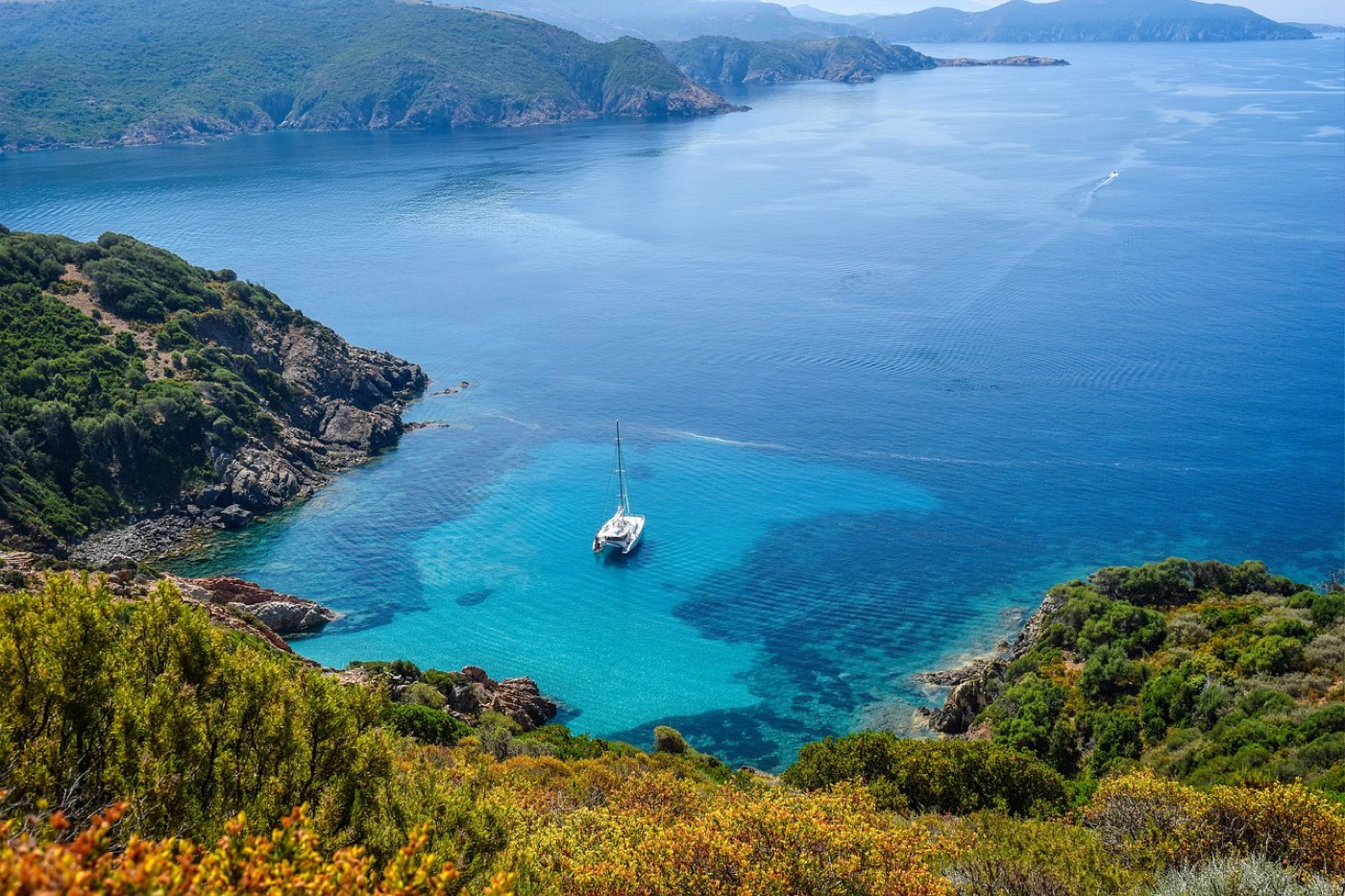
South Mauritius offers a contrast to the island’s busier zones. Coastal cliffs, sheltered coves and pockets of preserved nature shape a landscape that feels wilder and quieter. This page lists the main places to visit in the south and gives practical pointers for planning a visit.
Where is South Mauritius
South Mauritius covers the southern coastal belt of the island. The area stretches from the clear lagoon waters near Blue Bay to the rocky headlands and waterfalls further west and south. The landscape alternates between reef-fringed bays and abrupt cliffs that face the open ocean. Vegetation here ranges from coastal scrub to managed reserves on offshore islets.
The southern coast is less urbanized than the island’s northern resorts. Town centres are smaller and settlements sit closer to natural features. Roads link the coastal points but the terrain means some viewpoints are best reached on foot. The sense of space is one of the region’s defining traits.
Weather patterns shape the coastline. Wind and swell sculpt the rocky shores. The lagoon zones remain sheltered by reef structures that filter waves. These contrasts produce different experiences within short distances: calm, shallow waters for close-to-shore activities, and raw surf along exposed cliffs.
Blue Bay and the marine park
Blue Bay sits along the southeastern shore and is known for a clear, shallow lagoon. The marine area is managed to preserve coral formations and reef life. The water clarity makes the reef features and fishlife easy to observe from the surface. Snorkeling is the common way to experience the lagoon and its coral gardens.
The lagoon is separated from the open sea by a reef barrier. That barrier protects the inner waters and creates an environment where corals can grow in relative calm. Coral assemblages here include branching and massive forms. Reef fish of many shapes and colors frequent these habitats.
Visitors typically approach the lagoon from the shore or by small craft. Observing reef life from a secure vantage is recommended. Wear reef-safe sun protection and use care around fragile coral structures. Low-impact practices help preserve the reef’s condition for other visitors and for marine life.
Respect for protected regulations is part of visiting. Access rules aim to reduce physical damage to corals and disturbance of marine species. Follow local guidance while in the lagoon, and avoid touching reef organisms or removing living material. Small changes in behaviour by many visitors help keep the habitat healthy.
Île aux Aigrettes: a nature reserve
Île aux Aigrettes is a small offshore islet managed for conservation. It hosts vegetation types that have become rare on the main island. Native plants and reintroduced species form a distinct plant assemblage compared with mainland shorelines.
The islet provides habitat for endemic fauna and for birdlife that rely on predator-free conditions. Active management on the islet focuses on preserving plant communities and on providing secure nesting sites for sensitive species. Coastal habitats here include seabird roosts and dune vegetation adapted to salt spray.
Access to the islet is by boat. Visits are oriented around conservation and interpretation. Walks on the islet are generally guided to limit impact and to convey the significance of habitat restoration. The reserve’s approach centers on protecting fragile ecosystems while giving visitors a chance to see species that are scarce elsewhere on the island.
The wild coastline: Souillac and Gris-Gris
Souillac and the nearby Gris-Gris area form a stretch of coastline where the ocean meets steep cliffs. The sea here batter the shore with open-ocean energy. Waves crash into bare rock and carve dramatic shorelines. The result is a coastal scene of exposed headlands and panoramic ocean views.
Cliff-top vantage points provide sweeping views of the horizon and of the rocky shore below. Vegetation on the cliff edges tends to be low and wind-sculpted. The coastal geomorphology includes fractured rock faces and rugged outcrops that have resisted erosion in other zones.
Along this coast, sheltered bays are rare and swimming spots are limited to rock-fringed coves with calmer waters. The contrast between sheltered lagoon areas and the open, wave-pounded cliffs is sharp. Photographic opportunities are abundant for those who value dramatic seascapes and raw shoreline textures.
Respect for safety is essential when exploring cliff edges. Slippery rock and strong sea spray create hazards near the waterline. Paths and viewing points offer safer ways to enjoy the scenery without putting oneself at risk.
Rochester Falls
Rochester Falls sits inland from the southern shore and is notable for a waterfall that flows over distinct rock formations. The rock face exhibits a blocky, geometric appearance that contrasts with softer, eroded stone found elsewhere. Water flowing over the ledge creates a clear, vertical sheet before it enters a pool below.
The setting around the falls includes riverine vegetation and shaded areas that provide a cooler microclimate than exposed coastal spots. Rock formations around the pool create natural platforms and ledges. The mix of flowing water and hard basaltic or volcanic rock makes the site visually striking.
Access trails approach the falls through plantation and riparian growth. Visitors often combine a visit to the falls with nearby coastal points, forming a natural loop between inland water features and the shoreline. The contrast between the falls’ cool, green setting and the windswept coast adds variety to a southern itinerary.
Planning your time in the south
Designing an itinerary in the south depends on interests. Nature lovers will split time between the lagoon areas and the protected islet. Sightseers who favour dramatic coastlines will prioritise the cliff vantage points and coastal drives. Those seeking a mix should combine the reef lagoon with an inland visit to the waterfall.
Start with a coastal morning to benefit from calmer sea conditions in sheltered bays. Snorkeling and lagoon observation are most comfortable when winds are light. Later, shift to the rugged coast where wind and swell create the dramatic scenes that define Souillac and Gris-Gris.
Include a visit to the reserve islet as a distinct element of a nature-focused plan. The islet’s restored habitats and endemic species contrast with mainland vegetation. Time on the islet is best used for guided walks that explain conservation work and that keep visitor impact low.
Combine inland and coastal sites for variety. The waterfall offers shaded terrain and a change of pace from exposed headlands. Mixing inland and coastal visits reduces time spent in any single environment and broadens the overall experience.
Transport considerations matter. The southern road network links the principal points, but the landscape influences travel times. Allow for slower travel near lookout spots where roads narrow or where parking is set back from viewpoints. Planning around access points and trailheads helps avoid rushed visits.
Packing for the south requires simple items that suit varied environments. Sun protection and reef-safe sunscreen are useful for lagoon visits. Sturdy footwear supports cliff and waterfall trails. A light waterproof layer handles sudden showers that can affect coastal weather.
Respecting local conservation measures increases the quality of the visit. Avoid introducing pollutants to water bodies and keep to marked paths when visiting natural reserves and delicate shoreline zones. Responsible behaviour preserves habitats and ensures future visitors see the same features.
Suggested sequence for a balanced visit
Begin near the lagoon to enjoy sheltered marine life. Move to the reserve islet for a nature walk that highlights endemic species. Then head to the wild coastline for cliff-top views and dramatic seascapes. Finish with the waterfall to experience inland river scenery and a cooler setting.
This sequence mixes marine, island, coastal and inland environments. It reduces backtracking and provides a varied sensory experience through changing landscapes and ecosystems.
Practical notes for visitors
- Wear shoes suited to rough paths and wet rocks.
- Bring reef-safe sun protection for marine areas.
- Keep to designated paths and viewing points near cliffs and reserves.
- Carry water and a small first aid kit for remote stretches.
- Observe wildlife from a distance and avoid handling animals or plants.
How to combine sites
Pair the lagoon with the reserve islet for a marine and conservation day. Pair the cliff coast with the waterfall for dramatic land and water contrasts. Combining sites near each other reduces time on the road and increases time at points of interest.
Adjust the mix to match interests. Photographers will favour the cliff outlooks and waterfall. Snorkelers will focus on the lagoon and reef edges. Families and mixed groups can split activities across the same day to suit varied preferences.