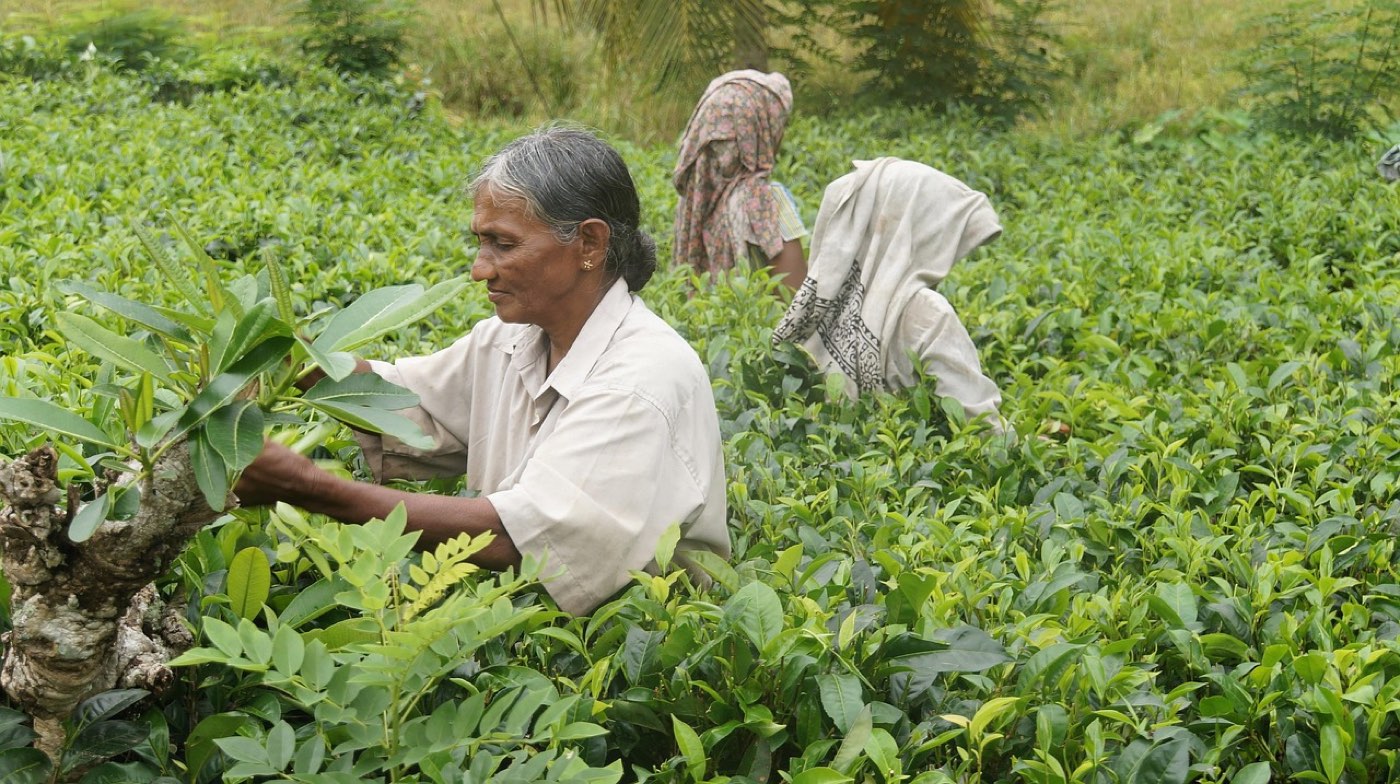
The Central Plateau of Mauritius sits inland at higher altitude than the coast, with a noticeably cooler, more humid climate and a landscape of green hills, colonial houses and tea cultivation.
Where is the Central Plateau
The Central Plateau occupies the middle of the island and includes towns such as Curepipe and Moka. The plateau lies inland, above the coastal belt, and forms a distinct band of higher ground that contrasts with the low-lying shoreline.
Altitude shapes the plateau’s environment. The higher ground brings cooler temperatures and greater humidity than the coast, and this influences local vegetation, light and cloud patterns. As a result, the plateau presents a different feel from seaside areas: air that is cooler and often fresher, and landscapes that tilt toward green hills rather than sandy beaches.
The land on the plateau combines built-up town centres with open fields and undulating hills. Roads crossing the region link the towns and provide access to viewpoints and rural lanes. The mixture of town, agricultural land and natural patches produces a varied setting for short visits or longer exploration.
Trou aux Cerfs volcanic crater
Trou aux Cerfs is an extinct volcanic crater located at Curepipe. The site is a circular crater basin with a path running around its rim. That rim affords views across wide parts of the island, allowing visitors to take in plains and distant coastal areas from high ground.
The perimeter path around the crater is suitable for a walk that follows most of the rim. The route is generally level and allows for regular stopping points to look out over the landscape. Vegetation around the crater frames the slopes and softens the edges of the basin, creating a mix of open outlooks and green enclosures.
Because the crater sits on the plateau’s higher ground, the atmosphere there is typically cooler and more humid than at sea level. This local climate can alter how light and cloud move across the view, and it gives the site a different sensory quality compared with coastal vantage points.
Colonial heritage houses
The Central Plateau contains examples of nineteenth-century colonial architecture tied to the island’s plantation era. These houses reflect construction styles and domestic arrangements from that period and stand as physical witnesses to past ways of life.
Some of those heritage houses are open to visitors as displays of period architecture and domestic culture. Interiors, where accessible to the public, show layouts and materials used during the plantation era. Exteriors present proportions and rooflines typical of colonial estates, which contribute to the region’s built character.
Walking among these houses and their surroundings gives a sense of local history. They sit within town or countryside settings and are often accompanied by gardens, fences or cultivated land. The cluster of historic buildings adds texture to the plateau’s towns and lanes and offers subjects for visitors interested in architecture and historical landscapes.
Tea country landscapes
The central region includes areas of tea cultivation that shape the scenery with green, gently undulating rows and hedgerows. Tea fields form part of the plateau’s agricultural mosaic and create a patchwork of cultivated slopes and valleys.
Moving through the tea country reveals repeated vistas of planted slopes and terraces. The regular lines of planting and the contrast with natural scrub or forested patches produce a landscape that combines order and variation. The presence of tea plantings links the plateau to agricultural traditions that have influenced land use and scenery.
Tea fields appear beside rural roads and near small settlements, integrating cultivation into everyday countryside views. The combination of higher humidity and cooler temperatures on the plateau supports these crops and helps define the visual identity of the central hills.
Planning your time on the plateau
Decide which type of experience you want first: a viewpoint around the crater, a walk among colonial houses, or a drive through tea-country scenery. Each offers a different tempo and set of impressions, so grouping similar activities reduces transit and helps you enjoy each stop more fully.
Group visits by proximity to avoid repeated transfers across winding roads. The plateau’s towns and rural sites sit close enough that several can be combined in a single outing if planned with geography in mind. Building a route that links nearby features makes the most of time on the plateau.
Pack clothing for changeable conditions. The plateau’s higher altitude brings cooler, more humid weather than on the coast, so layers that can be added or removed are practical. A light waterproof layer and sun protection cover the range of conditions that visitors may encounter while walking along a crater rim, strolling among heritage gardens, or moving through tea lanes.
Wear comfortable footwear suited to short walks and uneven ground. Paths around a crater rim and lanes between fields and houses vary in surface and slope; footwear that supports steady walking makes site visits more pleasant. Bring water and small provisions for brief excursions, since carrying essentials simplifies shorter stops away from town centres.
Photography opportunities are plentiful: crater rims, period façades and patterned tea slopes offer varied subjects. Soft light often enhances texture and depth in the landscape; timing visits to coincide with gentle light conditions can improve image quality. Pausing at outlooks and taking time to frame a scene rewards those seeking detailed shots of architecture or landscape patterns.
Respect local property and signage while exploring the plateau. Many historic houses and cultivated slopes sit within managed grounds or community areas; staying on public paths and adhering to posted directions helps preserve gardens and crop plantings. Observing local markers and boundaries protects both heritage sites and agricultural land.
Plan for modest travel times between stops rather than assuming short distances equal short journeys. Topography and road alignment influence how long transfers take, so allow flexibility in itineraries to accommodate winding lanes and occasional stops for views or short walks. That approach keeps the day relaxed and better suited to the plateau’s quieter pace.